April is supposed to be the month when winter finally loosens its grip. Not this year. A historically potent late-season storm system is simultaneously battering 10 U.S. states with blizzard-level snowfall, delivering nearly 5 feet of snow to Alaska, and sending Arctic air surging southward to threaten nearly 100 million Americans with temperature swings of 20 to 40 degrees. All of this is unfolding alongside a separate but concurrent severe weather outbreak that has spawned nearly two dozen tornadoes from the Plains to New England. This is not a typical spring cold snap — it is one of the most geographically expansive weather events of the year, and it demands attention from anyone living between Boise and Boston.
The Western Snowstorm: Up to 2 Feet This Weekend
The core of the winter storm is centered across the West and Northern Rockies, where winter storm warnings are in effect across 10 states as of April 18, 2026. The Cascades and Northern Rockies are forecast to receive up to 24 inches of snow over the weekend — that's a full two feet of accumulation in mid-to-late April, when most ski resorts are winding down operations and hikers are planning spring treks.
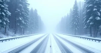
Colorado, Wyoming, Utah, and Idaho are bearing the brunt of the highway impacts. Forecasters are warning of 12 to 24 inches slamming major corridors, including Interstate 70 through the Colorado high country — a route that sees significant freight traffic year-round. In Utah and Colorado's mountain ranges, 8 to 16 inches are expected, while even Yellowstone National Park could see 4 to 8 inches of new snow accumulation.
The visual proof arrived early. On April 17, Coors Field in Denver was blanketed in snow ahead of the Colorado Rockies' four-game home series against the Los Angeles Dodgers, forcing grounds crews to cover the infield with a tarp. It was a fitting, if dramatic, symbol of just how far outside seasonal norms this event sits.
Alaska's Catastrophic Snowfall: Nearly 5 Feet Forecast
If the lower-48 storm seems severe, Alaska's situation is in a different category entirely. The National Weather Service has issued winter storm warnings across multiple Alaska regions with total snow accumulations of up to 58 inches — nearly 5 feet — forecast through Monday, April 21.
The warnings extend through Alaska's Yukon Delta Coast, where wind gusts up to 45 mph are forecast and visibilities could drop below a quarter mile. These are whiteout conditions in one of the most remote, supply-limited parts of North America. Communities in these areas have limited options for evacuation or resupply when storms of this magnitude arrive.
What makes Alaska's situation particularly significant is its broader context: the state just endured its coldest December through March in 50 years. This is not a one-off cold event — Alaska has been in the grip of a sustained anomalous cold pattern for months, and this latest storm is the exclamation point on an already historically brutal winter. Scientists and meteorologists are paying close attention to what this pattern signals about Arctic circulation dynamics in a changing climate.
The Arctic Air Blast: 100 Million Americans Affected
While the snowfall totals get the headlines, the Arctic air mass trailing this system is the element that touches the most lives. Nearly 100 million Americans from Boise, Idaho to Boston are facing freezing temperatures this weekend and into early next week — a geographic sweep that encompasses major population centers across the northern United States.
The temperature story is what makes this event genuinely unusual. Many of these same areas had been experiencing record-breaking warmth just days earlier, setting up a whiplash effect. Some locations are forecast to see temperature drops of 20 to 40 degrees within a matter of hours. AccuWeather notes that affected areas will experience temperatures running 10 to 25 degrees below the historical average for mid-April.
For people who have already packed away their winter gear — a reasonable assumption for mid-April — this kind of rapid reversal creates real logistical and safety challenges. Pipes that thaw and refreeze, overnight frosts that kill newly planted gardens, hypothermia risks for people not dressed for the conditions. The temperature crash is not just inconvenient; for vulnerable populations, it is genuinely dangerous. If you're driving in affected areas, an Emergency Car Kit with Flashlight, Food, and Water is worth having in your trunk right now.
The temperature volatility extends to Texas, where Austin residents are facing their own dramatic swing from 90°F to the 50s in a single weekend — a pattern consistent with the broader Arctic intrusion reshaping temperatures across a vast swath of the country.
Simultaneous Severe Weather: Tornadoes From Plains to New England
Here is the part of this story that gets lost when the snow totals dominate coverage: this is not just a winter storm. It is a massive, multi-hazard weather event. During the same week, nearly two dozen tornadoes and more than 600 severe weather reports have been logged from the Plains to New England — a staggering number that reflects how volatile the atmosphere becomes when Arctic air collides with warm, moisture-laden air from the Gulf.
Western New York, including Buffalo and Rochester, faces a dual threat: 9 inches of snow on I-70, 60 mph winds, and simultaneous tornado risk. This kind of overlap — where the same storm system delivers blizzard conditions in one location and tornado warnings in another — is a signature of powerful, fast-moving systems that span multiple climate zones.
On Saturday, April 18, the Storm Prediction Center identified a moderate risk area in Ohio for severe weather, the second-highest category on their scale. This affects millions of people who are not thinking about tornadoes in mid-April — and many of whom may also be dealing with the cold air trailing the system. Events in Ohio this weekend are particularly exposed to the weather disruption, with outdoor gatherings facing difficult conditions on multiple fronts.
Why a Late-April Storm This Powerful Is Significant
Meteorologically, late-April storms are not unheard of in the Mountain West or Alaska. But an event of this geographic scale and intensity — simultaneously affecting the West, the Midwest, the Northeast, and Alaska, with snowfall totals measured in feet rather than inches — is notable by any standard.
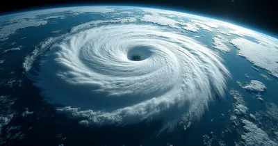
The driver is a deeply amplified jet stream pattern. When the polar vortex weakens or displaces, it sends lobes of Arctic air plunging south while simultaneously creating the atmospheric instability that fuels severe weather outbreaks. The result is the apparent contradiction we are seeing now: blizzard conditions in Colorado while tornado watches are active in Ohio. These are not separate events. They are two sides of the same atmospheric coin.
Alaska's 50-year cold record for December through March adds another dimension to this story. Persistent cold in Alaska often correlates with a disrupted polar vortex — a pattern that, counterintuitively, can send Arctic air surging into the lower 48 even as global average temperatures rise. The relationship between warming Arctic temperatures and increased mid-latitude winter weather volatility is an active area of research, and events like this one are data points in that ongoing scientific conversation.
How to Stay Safe During This Storm System
With warnings spanning from Alaska to the Northeast, safety preparation varies by region — but several principles apply universally when a storm of this scope arrives late in the season, when people's guard is down.
On the Road
Highway conditions are the most immediate threat for many affected areas. I-70 through Colorado and Wyoming, the mountain passes in Utah and Idaho, and secondary roads throughout the Northern Rockies will see rapid deterioration. If travel is unavoidable:
- Carry a Emergency Car Kit with Flashlight, Food, and Water — fuel, blankets, and water can mean the difference between a delay and a medical emergency.
- Keep a ice scraper and snow brush set accessible, not buried in the trunk.
- Check road condition apps before departure — CDOT and state DOT apps update conditions in near-real-time during major events.
At Home
The rapid temperature drop is the primary home hazard. Pipes in uninsulated spaces can freeze when temperatures plunge 20 to 40 degrees over hours. A pipe freeze protection heating cable on vulnerable pipes can prevent costly burst-pipe damage. Keep a heavy duty snow shovel near the door if you're in a snowfall zone — when 18 to 24 inches fall, standard lightweight shovels fail quickly.
Power Outages
Wind gusts of 45 mph in Alaska and 60 mph in parts of the Northeast create real power outage risk. A portable power station for home backup can keep phones, medical devices, and LED lighting running through multi-hour outages without the carbon monoxide risk of a gas generator indoors.
What This Storm Means: Analysis
The immediate practical implication is straightforward: this is a dangerous, disruptive weather event that demands respect regardless of the calendar date. The fact that it is happening in late April makes it more dangerous in some ways, not less — people have psychologically moved on from winter preparedness, road maintenance crews have scaled back, and the temperature contrast between the warm air being displaced and the Arctic air arriving means the atmosphere is highly energized.
The broader implication is about pattern recognition. A storm that simultaneously delivers near-record snowfall to Alaska (already finishing its coldest winter in half a century), blankets 10 western and midwestern states with blizzard conditions in late April, drives a multi-day tornado outbreak across the central and eastern U.S., and sends Arctic air to affect 100 million people is not a "weird spring cold snap." It is a major atmospheric event driven by a disrupted polar vortex and an amplified jet stream pattern that researchers increasingly associate with instability in Arctic circulation.
That doesn't mean every cold April storm is a climate signal. But the frequency and intensity of these late-season polar intrusions, combined with Alaska's historically cold winter, are worth tracking. The story of American weather in 2026 may ultimately be defined less by heat records — though those remain abundant — and more by the volatility between extremes.
Frequently Asked Questions
Which states have winter storm warnings right now?
As of April 18, 2026, winter storm warnings are active across 10 western, northern, and midwestern U.S. states, with the most severe impacts in Colorado, Wyoming, Utah, Idaho, and Montana. Alaska has separate winter storm warnings in effect through Monday, April 21, covering multiple regions with up to 58 inches of total snow accumulation forecast.
How much snow will Colorado and Utah get?
Mountain areas in Colorado and Utah are forecast to receive 8 to 16 inches, while the highest elevations of the Cascades and Northern Rockies could see up to 24 inches (2 feet). Yellowstone National Park is forecast to receive 4 to 8 inches. Interstate 70 and other high-elevation corridors are at high risk for closures and extended delays through the weekend.
Why is a late-April storm this severe unusual?
While the Mountain West and Alaska regularly see snow into May, a storm of this geographic breadth — simultaneously affecting 10 states plus Alaska, driving a tornado outbreak from the Plains to New England, and threatening 100 million people with Arctic temperatures — is exceptional for mid-to-late April. The atmospheric driver is an unusually deep, amplified jet stream pattern associated with a displaced polar vortex, which sends Arctic air surging south while simultaneously creating severe weather instability at the storm's warm boundary.
Is this connected to the tornado outbreak in the Midwest and Northeast?
Yes. The same large-scale weather system driving the snowstorm in the West is also responsible for the severe weather outbreak in the central and eastern United States. Nearly two dozen tornadoes and more than 600 severe weather reports have been recorded from the Plains to New England this week. When cold Arctic air collides with warm, moist air streaming north from the Gulf, the atmospheric instability fuels both phenomena simultaneously — blizzards on one side of the system, tornadoes on the other.
How long will the Arctic cold last?
Forecasters expect the coldest conditions to persist through early next week, with temperatures running 10 to 25 degrees below historical April averages in many areas. AccuWeather projects that the temperature plunge — which could reach 20 to 40 degrees in some locations — will moderate by mid-week as the Arctic air mass gradually retreats northward. However, the pattern is expected to remain unsettled, with no immediate return to the record warmth that preceded this storm.
The Bottom Line
A late-season storm system of rare geographic scope is reshaping conditions across the United States this weekend, from the snow-buried passes of the Northern Rockies to the tornado watches in Ohio to the near-whiteout conditions in coastal Alaska. Nearly 100 million Americans face freezing temperatures — many of them coming off record warmth just days prior — while the snowfall totals in the Cascades, Rockies, and Alaska are measured in feet, not inches.
The takeaway is not panic, but preparation. If you are in a winter storm warning zone, treat it with the same seriousness you would in January. If you are in the path of the Arctic air mass, expect pipes, plants, and plans to be disrupted. And if you are in the severe weather corridor from Arkansas through western New York, stay aware of rapidly changing conditions that can shift from rain to tornadoes to snow within hours. This storm does not care that it is almost May.