El Niño Watch 2026: Is a 'Godzilla' Event Coming?
NOAA Issues El Niño Watch for Late 2026: What a Potential 'Godzilla' Event Means for Your Weather
Weather forecasters are sounding the alarm for a potentially historic climate shift on the horizon. On March 19, 2026, NOAA's Climate Prediction Center issued a formal El Niño watch for late 2026, assigning a 62% probability of development — and a 1-in-3 chance the event could be classified as "strong." Some meteorologists are already using dramatic shorthand: Godzilla El Niño. If the forecast verifies, this could become the strongest El Niño in a decade, reshaping weather patterns across the United States and around the globe through 2026 and into 2027.
Here's everything you need to know about what's coming, when it will arrive, and how it could affect your region.
What Is El Niño — and Why Does It Matter So Much?
El Niño is a natural climate phenomenon characterized by the periodic warming of sea surface temperatures in the central and eastern tropical Pacific Ocean. It is part of a broader cycle called the El Niño-Southern Oscillation (ENSO), which alternates between three phases: El Niño (warm), La Niña (cool), and neutral.
During an El Niño event, the warmer-than-average Pacific waters pump enormous amounts of heat and moisture into the atmosphere, disrupting the jet stream and altering precipitation and temperature patterns worldwide. The effects are far-reaching: some regions experience devastating floods, others face record-breaking droughts, and global average temperatures typically spike during strong events.
The 2023–2024 El Niño offers a stark preview of what a powerful event can do. That episode was a major contributing factor behind NOAA declaring 2024 the world's warmest year on record — and scientists warn that a comparable or stronger event in late 2026 could push 2027 to an even more extreme benchmark. As recent reporting suggests, a "Super" El Niño could make 2027 the hottest year on record.
The 2026 El Niño Timeline: From La Niña to Neutral to a Potential Godzilla Event
Understanding where we are in the ENSO cycle right now is key to understanding what's ahead. As of March 2026, the globe is still in a La Niña pattern — the cool phase — which has been influencing weather across North America since late 2024. That La Niña is now winding down.
Here is the projected transition timeline:
- March–April 2026: La Niña weakens and conditions shift toward neutral, as forecast by NOAA.
- Late Summer 2026: Neutral conditions are expected to give way to a developing El Niño.
- October–December 2026: El Niño could reach its peak intensity — potentially entering "strong" territory.
This means that for residents of the Northeast and much of the country, spring 2026 weather will not yet reflect El Niño's influence. The La Niña pattern still holds sway through early spring, with the transition to neutral conditions expected around April. Meteorologists in New Jersey and the broader Northeast confirm that spring forecasts remain tied to La Niña's departing fingerprint, not the arriving El Niño.
For regions like Oregon and the Pacific Northwest, the La Niña winter has already drawn to a close. Oregon's La Niña winter ends as El Niño looms on the horizon, setting the stage for a dramatically different weather regime by fall.
What Could a Strong El Niño Mean for U.S. Weather?
The potential impacts of a strong El Niño event are wide-ranging and, in some cases, severe. Scientists and meteorologists are already modeling several key scenarios:
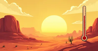
Heat Waves and Record Temperatures
A strong El Niño supercharges global average temperatures on top of the already elevated baseline caused by climate change. The 2024 El Niño drove NOAA to declare that year the hottest on record. A stronger 2026–2027 event layered atop rising background temperatures could mean unprecedented heat waves across the southern and western United States, and potentially record global temperatures in 2027.
Flooding in the South and West
El Niño typically steers the Pacific jet stream southward, pushing storm systems into California, the Gulf Coast, and the Southeast. This can bring heavy rainfall, flash flooding, and mudslides to regions already stressed by previous drought. Parts of the Midwest and Great Lakes may also see wetter-than-average conditions during strong El Niño winters.
Drought and Wildfire Risk
While some areas flood, others bake. El Niño tends to bring drier, warmer conditions to the Pacific Northwest and parts of the northern tier of the U.S. This increases wildfire risk significantly, particularly through summer and fall 2026 when El Niño is expected to be strengthening. Drought conditions across parts of the Plains and northern states are also a concern.
Impacts on the Atlantic Hurricane Season
One of El Niño's more well-documented effects is its influence on Atlantic hurricane activity. Strong El Niño events typically produce increased wind shear over the Atlantic, which disrupts the formation and intensification of tropical storms and hurricanes. This means a developing El Niño could provide some relief from hurricane activity in the Atlantic basin during the 2026 season — a potential silver lining for coastal communities from Florida to New England.
Conversely, El Niño tends to amplify hurricane activity in the eastern and central Pacific, posing heightened risks to Hawaii, Mexico, and Pacific coastal regions.
For a regional breakdown of what El Niño could mean for the upper Midwest, Wisconsin forecasters are already weighing in on expected impacts.
Why Are Scientists Calling This a Potential 'Godzilla' El Niño?
The "Godzilla" nickname is not official scientific terminology — but it conveys something real. It is typically applied to El Niño events that are projected or observed to be among the most intense on record. The benchmark event is the 1997–1998 El Niño, which remains one of the strongest ever measured and caused an estimated $45 billion in global damages.
The 2015–2016 El Niño was also dubbed a "Godzilla" event, setting modern records for Pacific sea surface temperature anomalies. NOAA's 1-in-3 odds of a "strong" event in late 2026 — combined with the already-warm baseline state of the Pacific Ocean — is what has some forecasters dusting off the alarming nickname once more.
Critically, climate scientists note that El Niño events today are not operating in the same atmospheric environment as those of 30 years ago. Elevated greenhouse gas concentrations mean the background temperature is already higher, which can amplify El Niño's warming impact on top of an already record-warm baseline. Meteorologists emphasize that even a moderate El Niño today can produce impacts that would previously have required a strong event.
What Should You Do to Prepare?
While El Niño is still months away from developing, there are practical steps households and communities can take now:
- Stay informed: Monitor NOAA's monthly ENSO updates and seasonal outlooks, which are released regularly by the Climate Prediction Center.
- Wildfire preparedness: If you live in fire-prone areas of the West or Pacific Northwest, begin creating defensible space around your property and assembling emergency go-bags well before fire season peaks.
- Flood planning: Southern and coastal residents should review flood insurance policies and familiarize themselves with local evacuation routes, particularly ahead of winter 2026–2027.
- Home cooling readiness: With potential heat waves on the horizon, inspect air conditioning systems and identify nearby cooling centers in your community.
- Water conservation: Residents in northern states and the Pacific Northwest, where drought risk increases under El Niño, should begin thinking about water conservation practices.
Frequently Asked Questions About the 2026 El Niño
Will El Niño affect spring 2026 weather?
Not significantly. The current La Niña pattern is still in place through early spring 2026, with a transition to neutral conditions expected around April. El Niño's impacts on U.S. weather are not expected to become noticeable until late summer and fall 2026, when the event is forecast to be developing or strengthening.
How likely is a strong or 'Godzilla' El Niño?
NOAA currently places the overall probability of El Niño development at 62%, with a 1-in-3 chance (approximately 33%) that the event will be classified as "strong." While those are meaningful odds, it is important to note that a strong event is not the most likely single outcome — but it is plausible enough to take seriously.
How does El Niño affect the Atlantic hurricane season?
Strong El Niño events tend to suppress Atlantic hurricane activity by increasing wind shear, which tears apart developing storms. This could mean a quieter-than-average Atlantic hurricane season in 2026 if El Niño develops as forecast. However, forecasters caution that a suppressed season does not mean zero risk — it only takes one landfalling storm to cause catastrophic damage.
Could this El Niño make 2027 the hottest year ever recorded?
It is a real possibility that scientists are already flagging. A strong El Niño typically causes its largest spike in global temperatures about 6–12 months after peak intensity. If the 2026 El Niño peaks in late 2026, 2027 could see the full brunt of its warming effect — layered on top of the already record-warm global baseline. Several climate scientists have said that 2027 breaking the 2024 record is plausible under a strong El Niño scenario.
Where will El Niño's impacts be felt most strongly in the U.S.?
Historically, strong El Niño events bring the most pronounced effects to California (heavy rainfall, flooding), the Gulf Coast (wet conditions), the Pacific Northwest (drought and warmth), and the southern tier of the country. The northeastern U.S. often experiences milder winters during El Niño years. Wildfire risk increases across the West during summer and fall.
The Bottom Line
NOAA's March 2026 El Niño watch is a significant signal that a major climate transition is underway. While the current La Niña still shapes spring weather across much of the U.S., the coming months will mark a pivotal shift: from La Niña to neutral, and potentially to a strong or even historic El Niño by late 2026. The consequences — from increased wildfire and drought risk to flooding, heat waves, and a potentially suppressed Atlantic hurricane season — underscore why this is one of the most closely watched climate developments in years.
Whether or not the "Godzilla" label ultimately applies, the science is clear: a strong El Niño in a record-warm world is a serious event with serious implications. Now is the time to stay informed, monitor updates from NOAA, and begin thinking about how your region could be affected when El Niño makes its presence felt later this year.
Weather Alerts
Severe weather updates and forecasts delivered fast.
Sources
Weather Alerts
Severe weather updates and forecasts delivered fast.
No spam. Unsubscribe anytime.